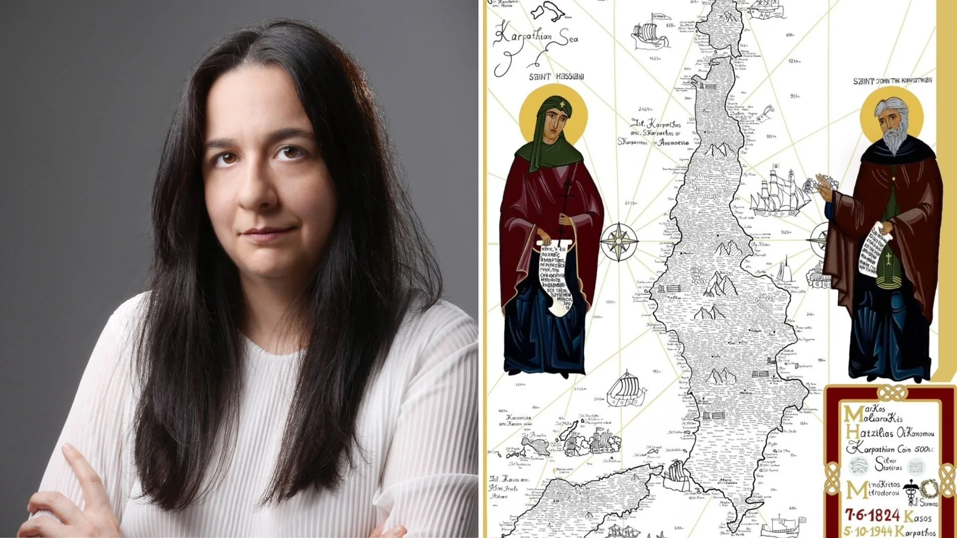
Introducing Maria Konstantina Andrianopoulou, the Greek author and researcher from Athens, Greece with a passion for Greek history. Maria recently spoke with The Greek Herald to reveal her latest project – a comprehensive map developed to showcase two significant Greek islands.
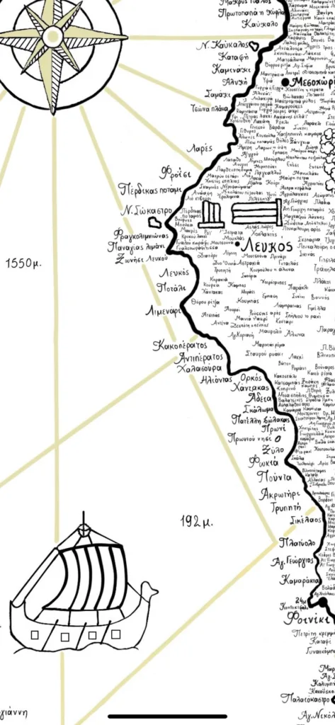
“It is a bilingual map, both in Greek and English, and records over 2900 toponyms,” Maria told The Greek Herald.
“The map serves as a cultural and historical record, which documents significant dates and individuals who have shaped the history of Karpathos and Kasos.
“Its purpose is to ensure that these names are not forgotten over time, and to remind us of the islands’ linguistic heritage.”
What does the map feature?
Maria shared that her map not only features the two Greek islands, but their surrounding rocky islets, as well as some significant names in Karpathos’ and Kasos’ history.
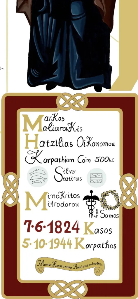
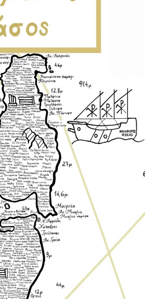
“The map also includes mountain heights and sea depths of the islands, and an ancient silver coin of Karpathos,” she said.
“As well as this, I have depicted the names of heroes of this time including Markos Malliarakis and Hatzilias Economou, as well as the two local saints of the island – Saint John of Karpathos and Saint Kassiani.”
Some of the other details carefully depicted on the map include the Kasos Holocaust, the historic naval battle off the coast of Karpathos, and the Byzantine emperor Nikephoros Phokas’ fleet that expelled Saracen pirates from the islet of Saria.
“The map aims to preserve and highlight the unique legacy of Karpathos and Kasos for future generations,” Maria added.

The influence and the map-making process
Maria said she initially decided to create the map as she saw a lack in maps and information about Kasos and Karpathos.
“I was inspired by the historic map created by Rigas Feraios, who played a pivotal role in the Greek War of Independence,” she said.
“I then wanted to create my own map, as I had never seen anyone do anything like it in Greece before.”
Maria said she began making the map during the summer of 2022 and completed it in August 2023.
“I did a lot of research to begin with and not only about the toponyms, but about the history, the culture, the religion and the geographical locations,” Maria said.
“It was not an easy process either. Although I did enjoy it, I also found it very difficult, because you have to check and double check all your information and the placements and be very careful.”
The mastermind behind the map shared how it felt to see her work be completed after many months of hard work.
“I’m very happy that I have finished it,” Maria said.
She added that she entered her map in UNESCO’s European Cultural Contest, Europa Nostra Awards and made it all the way through to the second stage.


Maria’s plans for the future
Maria revealed what she hopes to achieve from creating her map.
“I now hope to publish it, so many people will have the opportunity to have this map and learn more about Kasos and Karpathos,” she said.
“I would then love to see it be used in schools in the future, as this map serves both a visual and educational tool. I also hope it inspires local authorities and cultural organisations to actively engage in the preservation of the two islands’ history.
“The map captures the essence of these islands, and by documenting these toponyms and the stories behind them, it ensures that future generations can learn about them and appreciate their roots.”
Maria said she hopes to publish her map sometime next year.
